


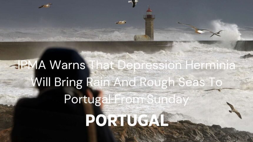
The Portuguese Institute of the Sea and Atmosphere (IPMA) has warned about depression Herminia in Portugal. This storm will bring heavy rain strong winds and rough seas which will start from Sunday. The North of Portugal will be affected first. The storm will then move to the rest of the country by Monday.
Read More About: PS/Madeira Leader Says He Is Prepared To Be President Of The Regional Government
Depression Herminia In Portugal
In its statement, IPMA issued several warnings:
- Yellow warnings for wind and snow.
- Orange warnings for rain.
- Red warnings for rough seas.
IPMA explained:
After depression Eowyn passed through Portugal, another system linked to depression Herminia will arrive
This storm will begin in the North early on Sunday, November 26th.
Rain will start in the Minho and Douro Litoral regions early Sunday morning. This rain will spread across the country during the day. It will be heavy and persistent especially south of the Montejunto-Estrela mountain range. The heaviest rain will occur between Sunday night and Monday morning.
Winds will also be strong. Winds could hit 70 to 90 kilometers per hour along the coast. They will blow from the south or southwest. Gusts may reach 100 to 110 kilometers per hour in the mountains of North and Centre areas.
The IPMA also warned about possible thunderstorms during this time. These storms will add to the bad weather conditions.
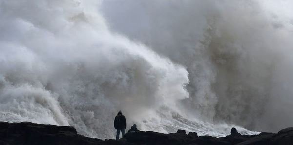
Rough Seas Warning
The sea will also be dangerous. Waves on the west coast will reach 4 to 5 meters from Sunday morning until Tuesday evening. Waves could be as high as 11 meters at their peak. This makes the sea very unsafe.
The waves will be even bigger North of Cabo Mondego. Between Monday afternoon and Tuesday morning, waves there could reach 7 to 8 meters. These conditions will be very risky for people living near the coast or those working at sea.
How To Prepare For Depression Herminia
IPMA has asked people to take precautions. Coastal areas will face the worst conditions with high waves and strong winds. People in these areas should avoid traveling and stay away from the sea.
Inland areas will experience heavy rain and strong winds. Residents should secure loose items that might blow away. They should also check that sewer systems are clear to prevent floods. Drivers should be extra careful because the roads will be slippery and sight might be poor.
Authorities are also preparing for the storm. Emergency services are ready to act if needed. Transport systems are being monitored to ensure they can operate safely during the storm.
Extreme Weather
Depression Herminia is the latest in a series of storms hitting Portugal this year. The country has faced many weather challenges recently. These events show how weather patterns are becoming less predictable.
Experts think climate change is making storms bigger and more common. Rising temperatures around the world add to these changes. Portugal long coastline and varied geography make it especially vulnerable to extreme weather.
The government is investing in better infrastructure to handle these challenges. This includes improved drainage systems and stronger coastal defenses. Public awareness campaigns are also teaching people how to stay safe during severe weather.
Safety is the top priority because depression Herminia approaches. IPMA will keep monitoring the weather and updating the public. People should stay informed by checking weather reports and following advice from authorities.
This storm reminds us of the importance of being prepared. Portugal can protect its people and recover quickly from such events by taking steps to reduce risks.
Depression Herminia will bring heavy rain and rough seas to Portugal. Warnings are in place and everyone should take precautions.